Planning Context
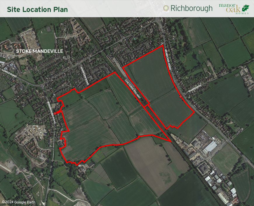
The Site is located to the south of Stoke Mandeville, a village located to the south of Aylesbury. The Site is located within Wendover, Halton and Stoke Mandeville Ward and within the Stoke Mandeville Civil Parish boundary. The Site extends to approximately 46 hectares and consists of several parcels of agricultural land bound by hedgerow and trees. A railway line, the Chiltern Line linking Birmingham with London and stations in between, dissects the centre of the site.
Neighbouring uses adjoin the north, west and east boundaries with agricultural land to the south. Stoke Mandeville Railway Station is located to the north of the site.
The Site is located within the Aylesbury Vale Area of Buckinghamshire Council and is therefore covered by the adopted Vale of Aylesbury Local Plan (VALP). The VALP requires the delivery of 28,600 dwellings across the period 2013-2033 and to meet this need, it outlines a hierarchy of settlements appropriate to deliver housing in the right locations to enable sustainable development to take place. The site is located on the edge of Stoke Mandeville which is acknowledged in the VALP as a sustainable location for growth. Whilst this site sits outside but adjacent to the current settlement boundary, the Council is not currently able to demonstrate sufficient housing sites are available to meet its immediate land supply requirements.